Sullivan Lake Climbing

Last Updated: Aug, 2026
78
Boulders
Guide moderated by Jason Allemann & Kristal Dubois
ABOUT Sullivan Lake

This digital Sullivan Lake climbing guidebook gives you GPS navigation, verified topos, and beta for hundreds of climbs. Explore classics and hidden gems with offline access to maps, directions, and beta videos. Whether it's your first visit or fiftieth, KAYA makes your Sullivan Lake days smoother, safer, and more dialed.

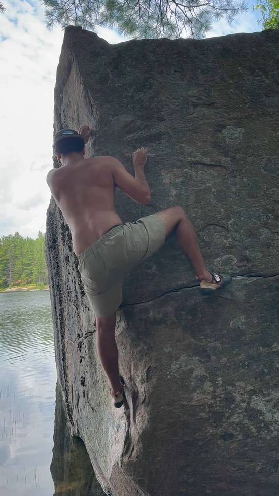
If you are a fan of camping, paddling, geology and climbing, it doesn’t get much better than this. Sullivan Lake is incredibly scenic, has awesome lakeside camping and some of the largest boulders you will ever see. The camping even comes with a canoe and rowboat, and some of the boulders are large enough to feature sport and trad climbing routes. The bouldering is okay too.

Access

The parking, approach, boulders and camping are all on Crown land. The area has long been used by hunters, fishermen and ATVers. Please minimize your impact by using the established campsi... Show more
This digital Sullivan Lake climbing guidebook gives you GPS navigation, verified topos, and beta for hundreds of climbs. Explore classics and hidden gems with offline access to maps, directions, and beta videos. Whether it's your first visit or fiftieth, KAYA makes your Sullivan Lake days smoother, safer, and more dialed. If you are a fan of camping, paddling, geology and climbing, it doesn’t get much better than this. Sullivan Lake is incredibly scenic, has awesome lakeside camping and some of the largest boulders you will ever see. The camping even comes with a canoe and rowboat, and some of the boulders are large enough to feature sport and trad climbing routes. The bouldering is okay too. Access The parking, approach, boulders and camping are all on Crown land. The area has long been used by hunters, fishermen and ATVers. Please minimize your impact by using the established campsites, and be respectful of other user groups. Good to Know If you are up for the adventure, it is worth backpacking in for a weekend. There are several established campsites around the lake. Sullivan Lake and Snowshoe Lake are stocked with brook trout if you enjoy fishing. Pack your swimsuit if you’re going on a warm day. History Alex Atkin's herbalist first told him about some “big” boulders near Sullivan Lake. It wasn’t long before a crew of climbers descended on the area, with most of the problems being established during the spring and fall of 2023. The main parking area for Sullivan Lake is approximately 30 km southwest of Calabogie, and the drive should take around 30 minutes. Unfortunately, the last 2.4 km is on an unmaintained forest service road, which has slowly deteriorated over the last several years. As of 2025, a 4x4 high clearance vehicle would have little problem getting to the main parking location. With anything less, how close you park depends on how comfortable you are with driving on rough terrain. There are many places to park along this last section of the road. Obviously, the further away you park, the longer you will have to hike. From Calabogie, drive south on Calabogie Road (County Road 508), past the ski hill and Eagle’s Nest parking lot. This road eventually turns into Hydro Dam Road, which takes you to the Hydro Dam. Turn left onto Mountain Chute Road, crossing the bridge below the dam. At the top of the hill you will come to the intersection with Norcan Lake Lane on the left. The directions below are from this intersection. Reset your trip odometer here if you want to follow the mileage. 0.0 km - Continue straight through the intersection onto a gravel road, taking you through a large open staging area. 0.3 km - Turn left onto Hunt Camp Lane. This is a generally well maintained gravel road. 4.0 km - Stay right, continuing on Hunt Camp Lane. 5.7 km - Turn left, continuing on Hunt Camp Lane. 6.2 km - Turn left, leaving Hunt Camp Lane, onto the forest service road. This is where the fun driving begins. If you are not comfortable driving down this road, you can park at P4, the large staging area you passed a few hundred meters back on the left. 6.5 km - Turn left at the split. A few hundred meters past this point, you will come to a steep hill, which is currently the crux of the driving. If you can’t make it up this hill, there is a small pullout (P3) just before it. If you can make it up this hill, you should be able to make it to P2. 8.1 km - Continue on the right fork. The road looks like it’s in great shape, but there is a deep washout just before P1. If you can’t make it through that washout, your best bet is to park here, so that you don’t block the road. 8.6 km - Park where the obvious ATV trail branches off to the right. If you can make it to the main parking location, you can expect a 30 minute hike to get to the Giant’s Marbles area. Most of the approach is along wide, established ATV trails.

OFFLINE MAPS + APPROACH

Get the full experience in the app.
Download KAYA

Recent Ascents in Sullivan Lake

KAYA CLIMBER
CLIMB
DETAILS
DATE
DAMIAN SAMUEL
@DynoDamian
One Lake v3
★ 3(v3, Solid)
7.13.2025
WEATHER
SEASON CHART
APPROACH
Forecast for Sullivan Lake
Powered by the Tomorrow.io Weather API

Areas in Calabogie

Explore Calabogie from all levels with KAYA PRO. Drill down to the area, subarea, boulder and climb levels. Get approach information for each, and a variety of beta.
Download KAYA